Spatial analysis made simple with PISA

Deforestation analysis in three clicks

Gain access to a cutting-edge system, designed by leading experts to meet your company’s specific needs—no GIS expertise required.
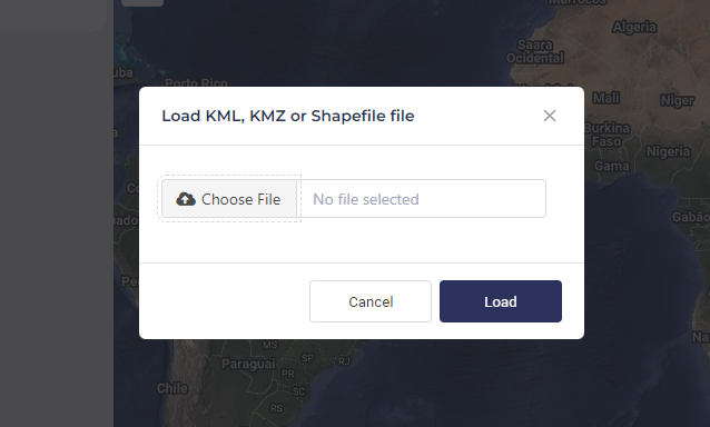
1. Upload your plot

Easily upload your area of interest. PISA allows you to share the essential details needed for precise analysis, all in one place.

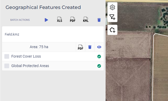
2. Run analysis

Select the desired data layers, and with just a few clicks, PISA will deliver a comprehensive spatial analysis tailored to your requirements.

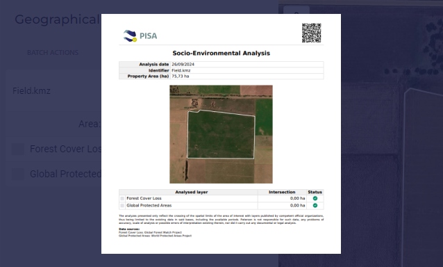
3. Export certificate

Receive a professional, ready-to-share report, complete with an authenticatable certificate, ensuring data credibility and easy sharing with stakeholders.

Additional features

Batch upload and analysis

Easily scale your assessments by analyzing multiple areas at once with our batch upload feature.

Custom filters

Create custom filters based on layer, year, cut-off date, and more for analysis tailored to your needs.

Local layers

Access localized data with PISA’s integrated regional layers, offering you reliable, actionable insights.

Ready to see PISA in action? Schedule a demo today